Mapping Mozambique’s Forest Loss Over 30 Years with GEO and the Brazilian National Institute for Space Research
October 06, 2021, New York
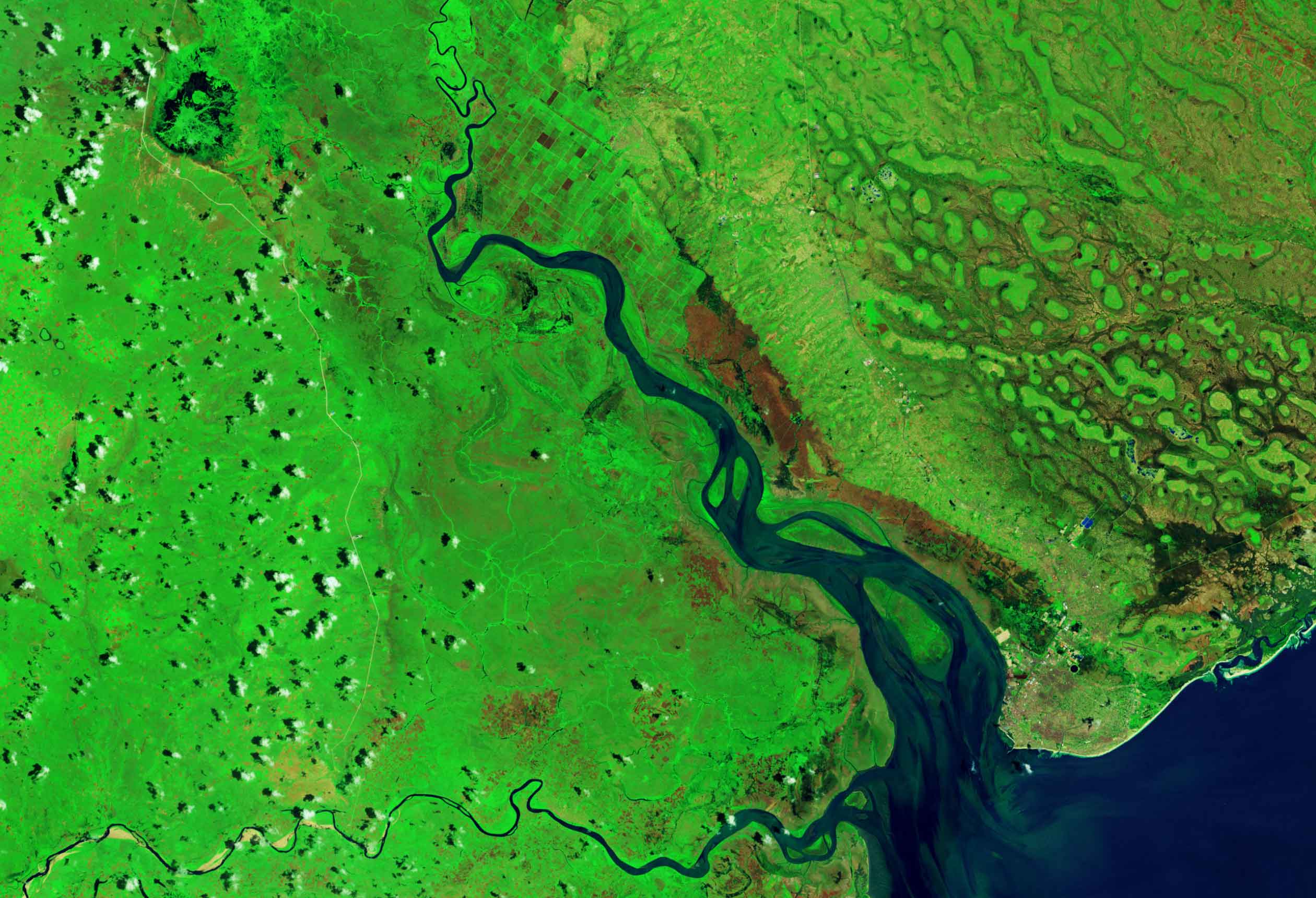
CfRN, the Group on Earth Observations (GEO) and the Brazilian National Institute for Space Research (INPE) kicked of their partnership, agreed in May 2021, with a 30-year forest mapping pilot project in Mozambique. The project will produce 30 years of Landsat image data for the entire territory of Mozambique from the years 1990 to 2020. The data will then be used as reference sets to create Mozambique’s annual land use and land cover maps for its UNFCCC REDD+ submissions.
“Most countries have only land use and land cover maps for specific years, as is the case of Mozambique,” says Federica Bietta, Managing Director, CfRN. “All the software tools and data sets we create in this pilot will be made available as open source, so other countries can use them to produce create land use and land cover information.”
The project is a cooperative initiative between the Coalition for Rainforest Nations (CfRN) and the Group on Earth Observations (GEO) in collaboration with the Brazilian National Institute for Space Research (INPE) and the government of Mozambique through the National Directorate of Forestry (DINAF), the National Directorate of Climate Change (DMC) under the Ministry of Land and Environment, and the National Fund for Sustainable Development (FNDS) under the Ministry of Agriculture and Rural Development.
The project team is processing and harmonizing more than 50,000 images from the satellites Landsat-5, Landsat-7 and Landsat-8 and producing monthly data cubes from these images, using the Amazon Web Services (AWS). using machine leaning and image time series analysis.
The first part of the project was 1). to evaluate Landsat images available in cloud platforms as the Amazon Web Services (AWS) for Mozambique from 1990 to 2020; (2) to develop software scripts to harmonize images from the satellites Landsat-5, Landsat-7 and Landsat-8 and to produce monthly data by selecting the best pixels available for each month; and (3) to get and analyze together with all the Mozambique partners, all available land use and land cover samples provided by FNDS and DINAF.
Preliminary results have now been presented and currently Mozambique is using the data to implement its analysis with Collect Earth Samples.


